Aerometrex has over 40 years of experience in the geospatial technology industry. With global expertise in 3D modeling, aerial imagery and LIDAR, the business has been recognised for its work across multiple continents.
Having started business in Australia, the company's US operations are headquartered in Denver, Colorado and have been established in response to the high demand for high resolution 3D reality modeling.
The global Aerometrex team has expanded to 100+ with industry experts in aerial mapping, flight planning, photogrammetry, 3D modeling, LiDAR processing, aviation, sales and marketing, and R&D.
We have always been at the forefront of spatial technology advances and pride ourselves on our exemplary customer service and delivering the very best product in the market. It is this ethos that has grown our business over time, with high levels of customer satisfaction.
Aerometrex products are renowned world-wide for very high standards of production quality and accuracy. Our product range is second to none. Whether you are a government official, a property developer, an engineer, a solar installer, an environmental scientist, a mine manager or a lawyer, you can trust our products.
To provide our customers accurate, high-quality, best-value data products that satisfy all their spatial data requirements
To provide professional, accurate digital geospatial solutions to our clients by exploiting both existing and emerging air and ground imaging technologies
A long operating history with a highly experienced workforce is a key strength of Aerometrex. Considerable ‘know-how’ and intellectual property has been accumulated by the company and is in daily use by its 100+ staff members.
Our people are our strongest asset and the assemblage of skills and experience is seen across a range of functions including aviation, aerial surveying, flight planning, photogrammetry, 3D modeling, LiDAR processing, sales and marketing, R&D, etc.
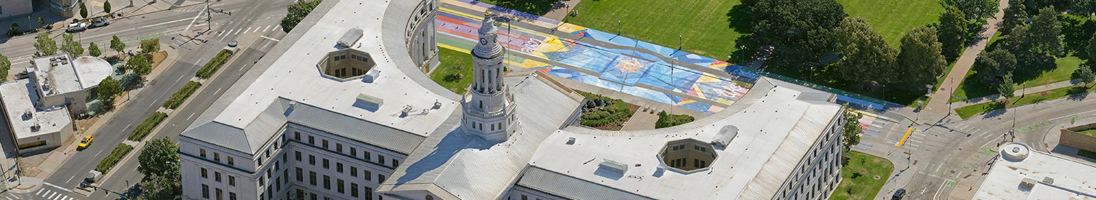
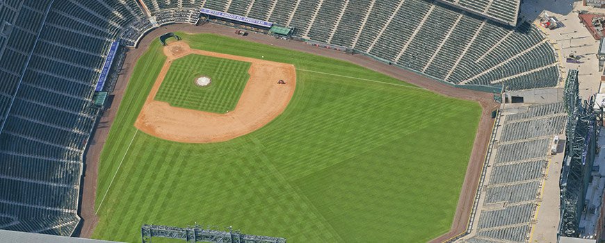
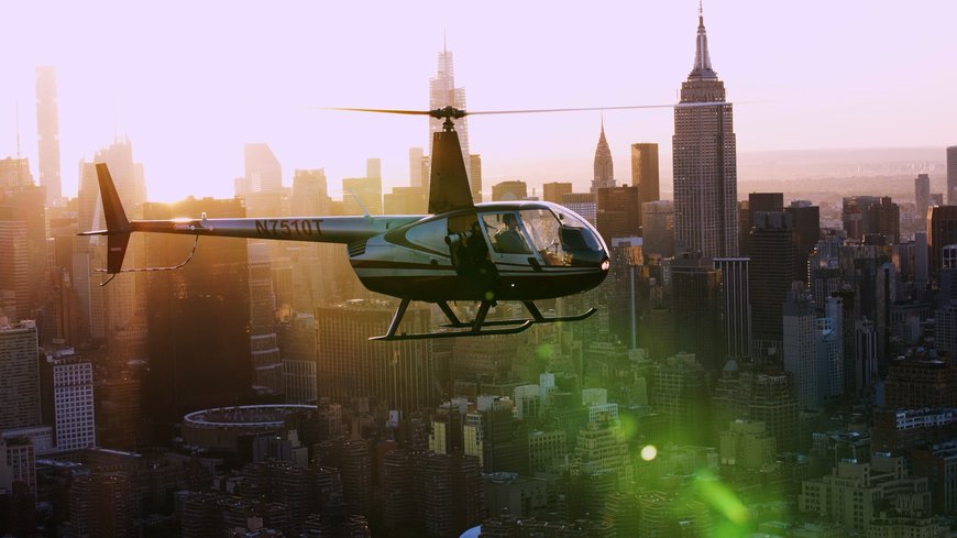
Aerometrex, across the globe, is renowned for its use of leading edge technology - from camera sensors to processing software. The company has its own aviation operations in Australia, offering the business a great amount of know-how in aerial capture. In the US, the company performs aerial captures via helicopter as well as ground-based captures for street-level enhancement of 3D models. With close to a decade of experience in building high resolution 3D models, the business has built proprietary capture methodologies and processing workflows to deliver the fastest and highest quality datasets to clients.
Aerometrex has completed large scale 3D modeling projects across the United States, Australia, New Zealand, and Europe. The company has worked with some of the largest tech companies such as Google and Microsoft, as part of their major aerial programs. The company has been at the forefront of expanding the usage of 3D reality models for various business cases.
Most recently, the company has been working with leading spatial software development companies as well as game engines to drive the visualisation of real world environments using 3D assets. The company's expertise in 3D mesh and LOD modeling has helped governments drive their smart cities and digital twin implementations, and serve as a backbone for city planning and development.
Aerometrex was also honoured with the Bentley ‘Be Inspired’ Award in 2016 for its 3D Reality Modelling for the Papal Visit to Philadelphia, USA.
Watch our corporate documentary by Viewpoint Project where we talk about our company, our products, our vision, and how critical 3D geospatial data is in meeting the challenges of the future.