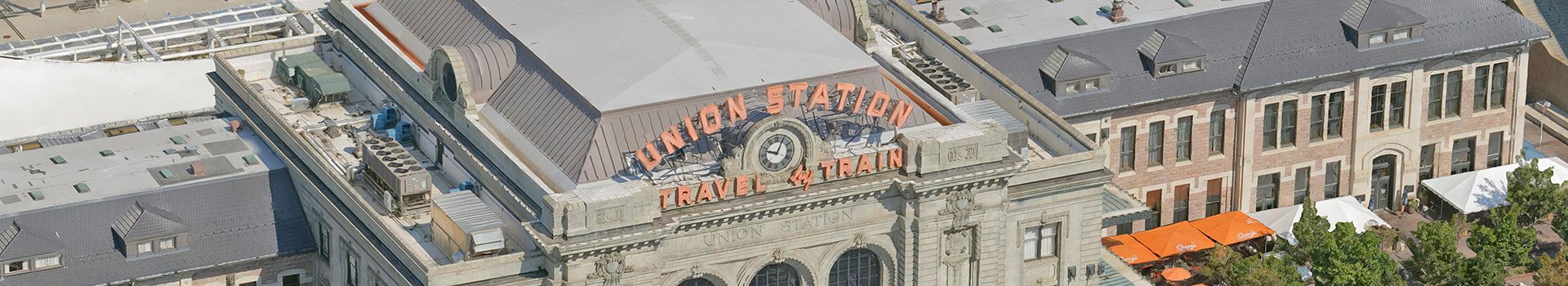
Our 3D data gives you access to high-resolution 3D reality mesh models that add context to your projects, help develop and visualize scenarios, and give a comprehensive 3D base dataset for planning, development and change monitoring.
We operate across the USA and Australia with capabilities to model anywhere across the globe. 3D data can be provided on a project basis, where we work with you to define your requirements and deliver the final dataset accordingly. We also provide off-the-shelf datasets for certain cities that you can purchase via our Store.
Before you purchase, you may wish to assess our quality, so go ahead and download a sample using the form below and experience Aerometrex 3D for yourself.
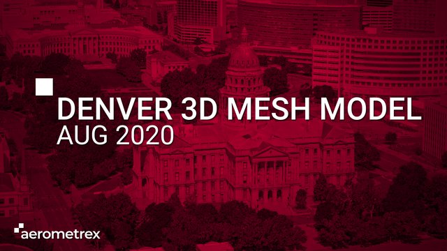
Experience Aerometrex 3D by downloading samples of our recent Denver 3D model in 2cm, 5 cm and Street-level resolution in OBJ, FBX, 3DTiles or SLPK formats.
Our 3D Reality Mesh Models are a multi-industry and multi-use solution for visualizing, managing, and monitoring changes to 3D spaces. We deliver high-resolution 3D models, enhanced with precise measurement, and accurate geolocation.
Our approach allows us to work with you to understand your requirements and tailor the best solution in terms of application-linked outputs, image resolution, accuracy, size and capture technique. We provide datasets in a range of CAD/GIS-ready 3D formats, packaged for online 3D platforms and also provide value-added services to extract 3D information, perform 3D change analysis and integrate additional spatial data to the 3D city models.
Level of Detail (LOD) models are representations of buildings at different scalable detail. We have multiple options for LOD models depending on client needs. The options below are a guide and we can add more details.
We are at the forefront of developing 3D visualizations for a range of projects. Our Research & Development team has been working on how to streamline large scale 3D model ingestion for game engines, which offer the ultimate in real-time model visualizations for the geospatial industry.
Dynamic lighting, realistic weather, and photogrammetry asset libraries make for a rich and diverse staging environment that can change to reflect real-world conditions. An architectural firm can re-create a fully-furnished apartment building and show real-world lighting to prospective buyers who can digitally walk through the property. Housing developments can model an entire neighborhood before it’s built and let people experience the space in virtual reality. Large infrastructure projects can place new structures within a city model and show a bridge or building as it will exist in the real world.
Artificial Intelligence and Machine Learning enable the classification of 3D reality mesh and allow for intuitive management of data that’s grounded in accurate renders of real-world spaces. They simplify the management of Smart Cities where ordinary objects will hold extraordinary abilities.
We start with a high-resolution capture of an urban area and use a mixture of aerial and ground imagery with photogrammetry as the basis of a realistic 3D mesh model. The next step is “classifying” the data. A limiting factor for mesh modeling in the past has been the lack of context to the images; objects in the 3D reality mesh models need to carry attribute data to maximize utility for city planners and managers. We use a mixture of manual and AI-driven processes to classify objects as buildings, trees, and others. Each classified object can then have databased information applied to it. Interactive 3D GIS solutions allow users to interact with and query the integrated classified 3D data.