Aerometrex has become a trusted 3D data provider for engineering and professional services giant WSP USA. WSP has, to date, purchased the company's Denver, San Francisco, Miami, and Los Angeles datasets and is currently commissioning 3D models for future projects across their broad range of work.
Our team spoke to WSP USA Vice President Tom Coleman (TC) and Technical Lead of the Visualization and Data Intelligence Group, Mark Kauffman (MK) about how our data has helped WSP operations, and to better understand the transition towards 3D as the default starting point for their projects. Read highlights of our chat below:
--
TC: We're involved in everything, and we're huge! It feels like we do projects in every first, second, and third-tier city in the country.
MK: What we do is kind of beyond comprehension. Broadly, we’re in engineering services that span the entire spectrum of the built environment: buildings, infrastructure, power, energy, water, and environment. We're a worldwide company of 56,000 people nowadays.
TC: Because we couldn't get it from anyone else! The data is so tremendous that the people we show it to inside the business are left scratching their heads.
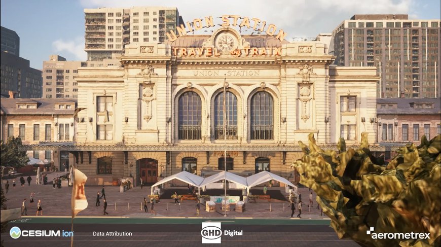
MK: To be perfectly honest, Aerometrex is the highest quality, highest resolution 3D data that we've seen so far available to us. Take the Denver model for instance - when I first saw that Union Station, it just blew my mind. That quality is important for the American market, where projects within the built environment are starting in 3D. These Aerometrex representative environments with a tolerance of two to five centimetres are pretty spectacular.
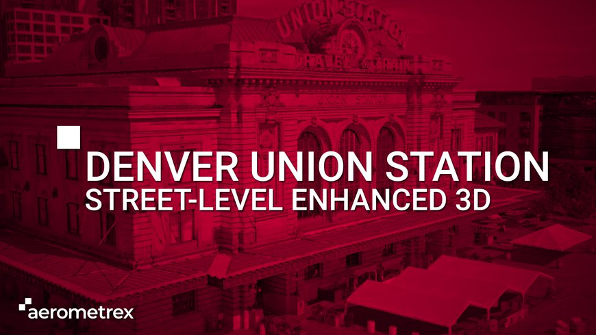
This video showcases the enhancement of our Denver 3D model using street-level imagery to more accurately depict the character of the historic Union Station.
MK: Starting with more accurate information from a 3D model makes staging data much easier. I can slice and dice the data, add buildings, get rid of the ground surfaces, or do whatever I need. Then I quickly and interactively build models in front of my clients and get that real-time feedback.
Also, the 3D reality mesh solves the data disconnect. Clients know there's a Starbucks here or Wells Fargo Bank building there, but in the past, all they’d see is a big extruded shape. I think that's a crucial aspect of what Aerometrex is offering. This reality mesh allows us to get beyond this kind of “foam core” of shapes that are somewhat volumetrically representative of the real world to something that's actually there in the real world.
I think it's crucial to note that Aerometrex can be the entire model, or it can be part of the broader data solution. I think, for a lot of what we're going to do, it will be part of the solution, but a very key part of the solution.
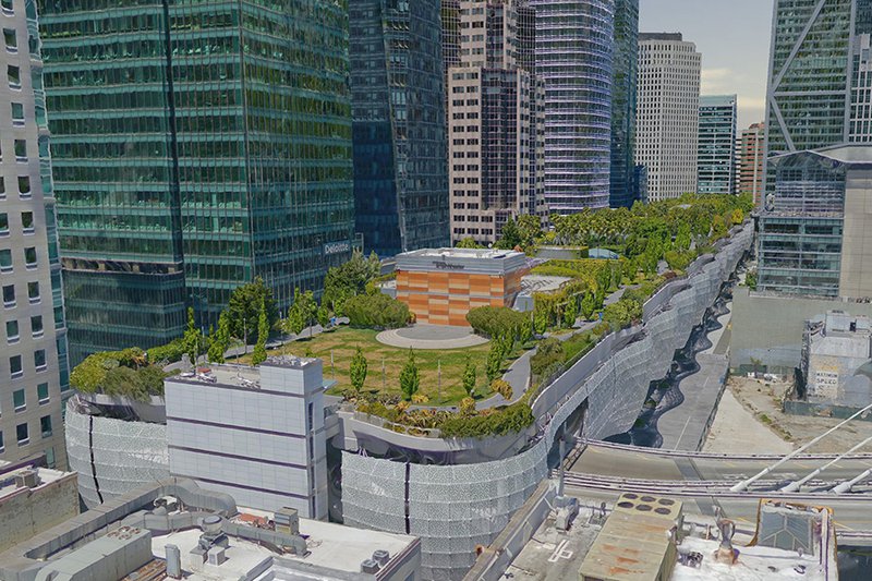
Salesforce Park from the 2 cm San Francisco model shows the quality of Aerometrex 3D data
MK: We used to build everything from scratch with GIS data and aerial maps, starting with 2d data and building it up in 3d. That's a lot of work, and you can only get to a certain level of detail. Now we're able to integrate these city-size models directly into game engines and stage complex scenes in real-time. Our teams look at the results and go - "You pulled that off in how many days?! " We can do what once took two or three weeks worth of back-and-forth in three hours. It quickly answers many questions, and you're moving the design forward from there.
TC: I think I shocked the group in Tampa out of their seat because they'd already spent so many hours building traditional models, then we saw that you have a new streaming model of the whole city! They got so excited by seeing that new data. We show the data to people and they say, "Wow, I didn't know you could do that with 3D models." We're not quite working at engineer or survey level detail but three centimetres horizontal or vertical accuracy is amazing at the scale of these 3D models.
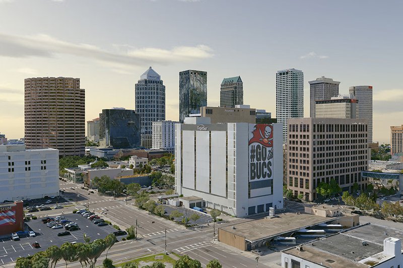
An image from Aerometrex's Tampa Bay 3D model
MK: We've started to migrate into Bentley's iTwin and OpenCities Planner environments. They work well because Aerometrex uses the Bentley technology on the production end. We use a lot of Autodesk tools; 3ds Max is like the one-stop shop for everything. And we use the Unreal game engine for interactive content.
GHD utilized Aerometrex's 3D model of Denver to create this showcase of how quality 3D data and advanced visualization platforms combine to make immersive and realistic infrastructure renditions.